

Software / AI
Software, AI and evidence workflows
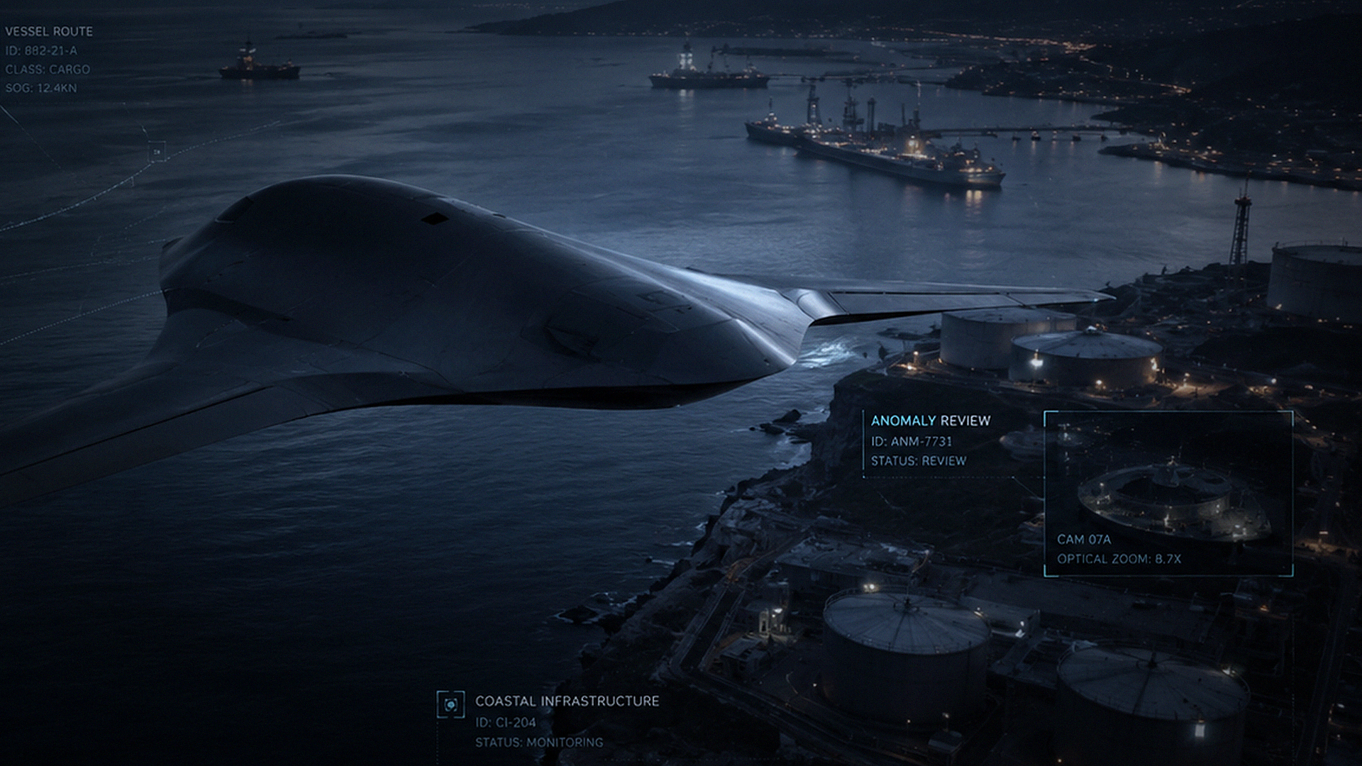
Mission software that turns sensor feeds into operator-reviewed events, tasking decisions, logs and briefing outputs.

Mission Context
Built around mission architecture, operator review and evidence-ready decisions
Sky Shadow uses AI language carefully: the public site frames software as decision support, anomaly review and workflow discipline rather than autonomous replacement of human judgement.
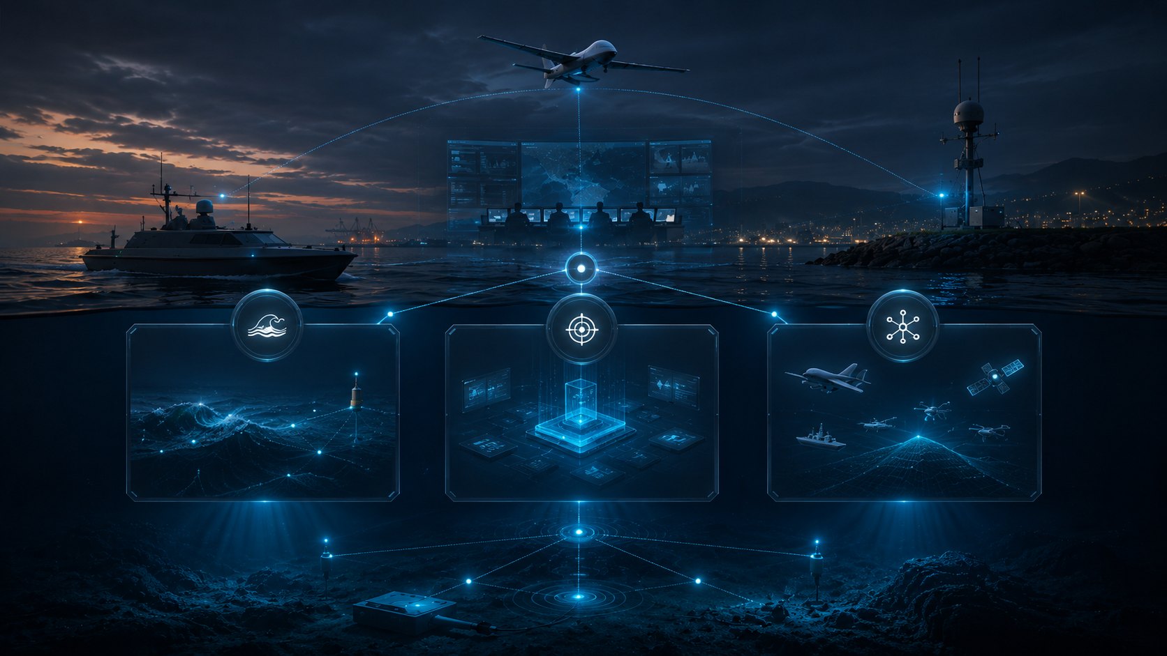
The software layer connects platforms, sensors, command workflows and reporting outputs so maritime, infrastructure and protected-site teams can understand what happened, why it matters and what must be reviewed next.


Capability Areas
What Sky Shadow brings together
Mission fit
The requirement is framed by site, asset, risk, operating authority, coverage need and evidence pathway.
- Mission definition
- Stakeholder context
- Pilot scope
Layered sensing
Air, surface, subsea and fixed-site sensing can be joined where the environment requires a multi-domain view.
- EO/IR
- RF / radar
- Acoustic / subsea
Human command
Autonomy supports repeatable tasking, event surfacing and sensor cueing while trained operators retain command.
- Operator review
- Escalation paths
- Audit trail
Evidence records
Events are structured into mission logs, briefing outputs and reviewable records for decision-makers.
- Research records
- Mission logs
- Briefing packs
Holo-Fusion View
One public view of platform status, sensor context and mission review
Holo-Fusion style mission views represent platform state, contact context, watch zones and operator review outputs without exposing site-sensitive configuration or restricted operating procedure.
Mission Systems
Software, sensing and evidence layers connected into one architecture
SHADOWCORE
Sensor fusion, anomaly review and mission intelligence layer.
ARGUS
Multi-sensor correlation and persistent watch layer.
AEGIS
Human-commanded tasking, escalation and command workflow layer.
Research
Evidence records, mission logs, reporting and briefing layer.
PHAROS
Fixed-site and perimeter awareness layer.
HORIZON-CUAS
Counter-UAS awareness layer for authorised operators.
Evidence Layer
Research records, event timelines and audit review without exposing restricted detail

Deployment Path
From requirement to controlled deployment
Map the mission
Define the site, assets, operating area and decision points.
Select the architecture
Choose platform, sensor, autonomy and evidence layers around the requirement.
Run a controlled pilot
Validate workflows, reporting outputs and support requirements.
Train and govern
Align operators, escalation paths, data handling and accountability.
Scale deliberately
Extend coverage only after the pilot route and support model are clear.
Procurement Notes
Buyer-facing structure, clean evidence and responsible public detail
Public information is intentionally high-level and defensive. Detailed deployment, integration and operational material is handled through a controlled briefing route.
Private Briefing
Discuss the mission context with Sky Shadow
Share the operating environment, asset group, timescale and preferred pilot route. Sky Shadow can then map the requirement to platform, sensing, command and evidence layers.